Fukushima Earthquake Altered Earth's Gravity
Dec 04, 2013 20:29

The Tohoku earthquake in 2011 which caused the Fukushima nuclear disaster did more than just wreckage to man-made structures. According to the European Space Agency's GOCE satellite, it changed Earth's gravity too.
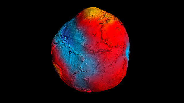
The Gravity Field and Steady-State Ocean Circulation Explorer, launched in 2009, collected data to map Earth's gravity with unrivaled precision. Gravity varies regionally due to uneven distribution of material deep within the earth.
GOCE was able to measure this variation to produce a detailed gravity map.

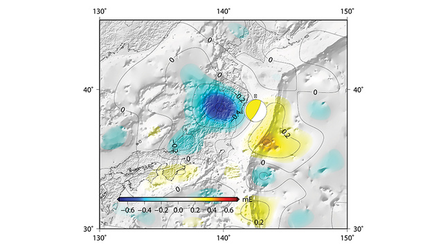
GOCE actually managed to capture a real-time change in gravity. The 2011 earthquake was the fifth-strongest ever recorded and it shifted rock formations several kilometers below earth's surface. It changed the shape of the sea bed and altered the gravitational pull of Japan's coast.

[European Space Agency]


